Map of Germany in 1920
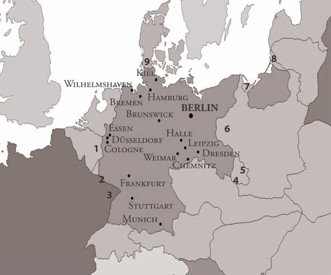
Map of Germany in 1920, after the Treaty of Versailles had been signed in June 1919. Numbered are the areas ceded or recognised by the German government:
1. Moresnet and Eupen-Malmady to Belgium
2. The output of Saar coalmines to France and control of the Saar to the League of Nations for fifteen years
3. The provinces of Alsace-Lorraine to France, overturning the treaty signed after the Franco-Prussian war of 1871
4. Parts of Upper Silesia to Czechoslovakia
5. Other parts of Upper Silesia to Poland
6. The province of Posen, which had been under Polish control since the Great Polish Uprising, Pomerania, the Soldau area, and other parts of south East Prussia (via plebiscite) to Poland
7. Danzig to the League of Nations
8. Memel to the League of Nations
9. Schleswig-Holstein to Denmark via plebiscite.