46. F. Engels. The History of Ireland
Natural Conditions
The country whose history is to occupy us is situated in the north-western corner of Europe, an island of 1,530 German or 32,500 English square miles. But between Ireland and the rest of Europe another island lies transversally, three times the size, which we for brevity's sake usually refer to as England; it completely encloses Ireland from the north, east and south-east, only leaving it a clear view in the direction of Spain, Western France and America.
The channel between the two islands, 50-70 English miles wide at the narrowest points in the south, 13 miles wide at one place in the north and 22 miles at another, enabled the Irish Scots in the north to emigrate to the neighbouring island and found the Kingdom of Scotland even before the 5th century. In the south it was too wide for the boats of the Irish and the Britons and even posed a serious obstacle to the Romans' flat-bottomed coasting vessels. But when the Frisians, Angles and Saxons, and after them the Scandinavians, ventured out on to the high seas, out of sight of land, in their keeled vessels, this channel was no longer an obstacle. Ireland became the object of raids by the Scandinavians and easy prey for the English. As soon as the Normans had formed a strong, uniform government in England, the influence of the larger neighbouring island made itself felt — in those days this meant a war of conquest.[185]
Then, in the course of the war, there followed a period when England attained supremacy at sea, thus ruling out the possibility of successful foreign intervention.
Once the whole of the larger island was finally united in a single state, it was then bound to attempt the complete assimilation of Ireland, too.
If this assimilation has succeeded, the whole process belongs to history. History is its judge, but it could never be reversed. If, however, assimilation has failed after seven hundred years of struggle; if instead all the intruders who swept in over Ireland in waves, one after the other, were assimilated by Ireland; if, even at present, the Irish are no more English, or "West Britons", as they are called, than the Poles are West Russians after a mere century of oppression; if the struggle is still not at an end and there is no prospect of any end at all except through the extermination of the oppressed RACE — if all this is so, then all the geographical excuses in the world will not suffice to prove that England's calling is to conquer Ireland.
In order to understand the soil conditions of present-day Ireland, we must go back a long way, right back to the age when the so-called carboniferous system was formed.(1)
T h e centre of Ireland, north and south of the line from Dublin to Galway, forms a wide plain at an average height of 100-300 feet above sea-level. This plain, the ground-plan — as it were — of all Ireland, comprises the massive layer of limestone, which forms the middle stratum of the carboniferous system (CARBONIFEROUS LIMESTONE) and immediately on top of which lie the coal-bearing strata (the COAI MEASURES a proper) in England and elsewhere.
In the south, as in the north, this plain is surrounded by a mountain chain which mainly follows the coastline and almost exclusively consists of older rock formations, which have broken through the limestone: granite, mica-schist, Cambrian, Cambro-Silurian, Upper Silurian, Devonian and the argillaceous schist and sandstone, rich in copper and lead, belonging to the bottom layer of the carboniferous system and containing,in addition, some gold, silver, tin, zinc, iron, cobalt, antimony glance, and manganese.
Only in a few places is the limestone itself high enough to form mountains: in the centre of the plain, in Queen's County,[186] rising to 600 feet, and in the west, on the southern shore of Galway Bay, rising to just over 1,000 feet (Burren Hills).
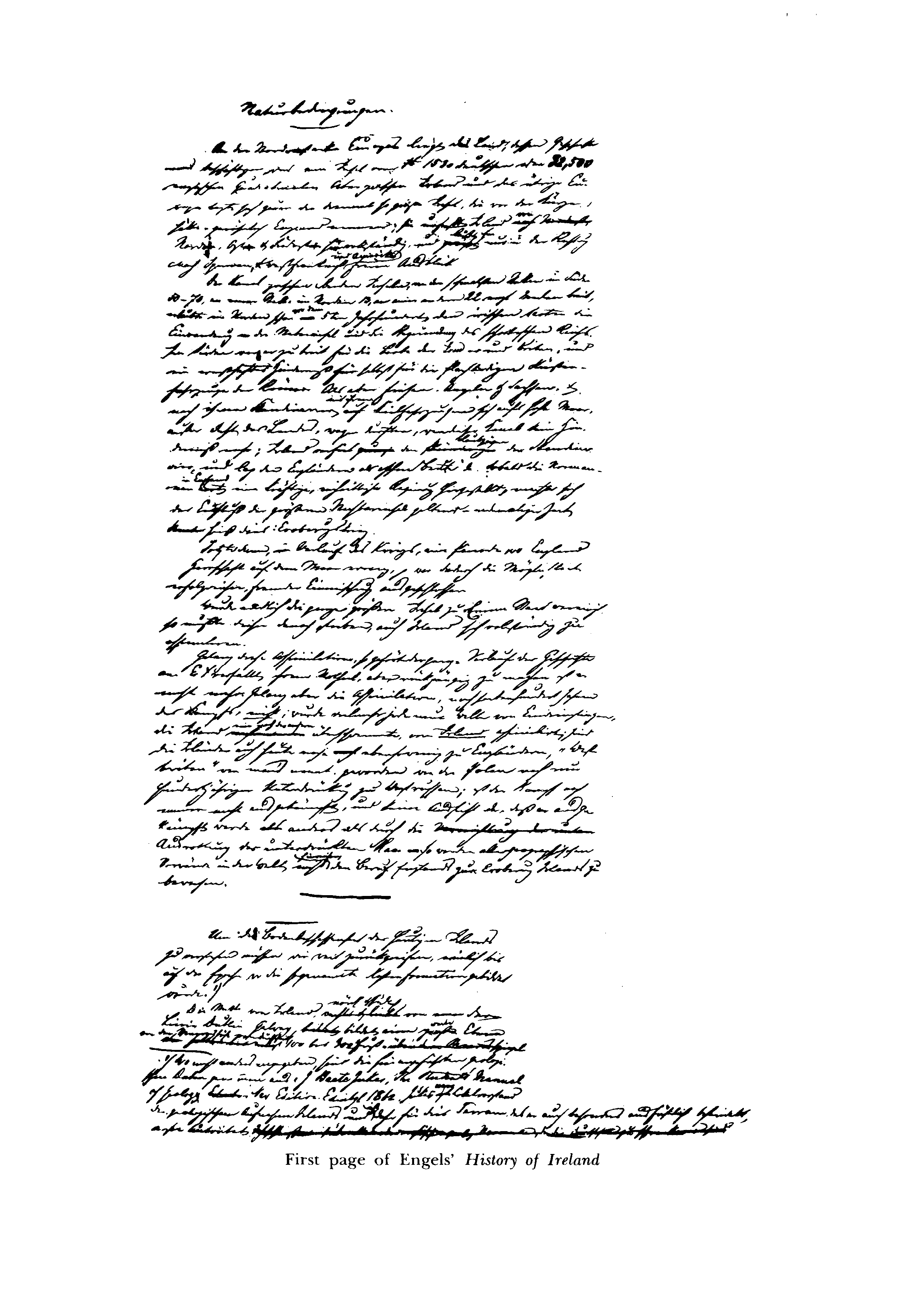
First page of Engels' History of Ireland
In several places in the southern half of the limestone plain there are isolated ranges of 700-1,000 feet [above] sea-level and of considerable extent, formed by the coal-bearing strata. They occur in synclines in the surface of the limestone, protruding from it as plateaus with fairly steep sides.
"The escarpments in these widely separated tracts of coal-measures are so similar, and the beds composing them so precisely alike, that it is impossible to suppose otherwise than that they originally formed continuous sheets of rock, although they are now separated by sixty or eighty miles.... This belief is strongly confirmed by the fact, that there are often, between the two larger areas, several little outlying patches in which the coal-measures are found capping the summits of small hills [...] and that wherever the undulation of the limestone is such as to b^ing its upper beds down beneath the level of the present surface of the ground, we invariably find some of the lower beds of the coal-measures coming in upon them" (Jukes, p. 286).(2)
Yet other factors, which would lead us into too much detail here and can be found in Jukes, pp. 286-89, leave no doubt that, as Jukes says, the entire central plain of Ireland is a result of denudation, so that, the coal-measures and the upper limestone deposits having been washed away — an average thickness of at least 2,000-3,000 feet, perhaps 5,000-6,000 feet of stone,—it is now principally the bottom layers of limestone that have emerged on the surface. Even on the highest ridge of the Burren Hills, County Clare, which consist of pure limestone and are 1,000 feet high, Jukes found (p. 513) yet another small outcrop of the coal-measures.
In fact, in the south of Ireland there are still some fairly significant tracts possessing coal-measures; but among them only isolated spots contain coal thick enough to make mining worth-while. Moreover, the coal itself is anthracitic, i.e. it contains little hydrogen and cannot be used for all industrial purposes without additives.
In the north of Ireland there are also several not very extensive coalfields whose coal is bituminous, i.e. ordinary pit-coal rich in hydrogen, and whose stratification does not entirely match that of the coal districts further south. It is, however, quite evident that the coal-measures were washed away here too: large pieces of coal, along with sandstone and blue clay from the same formation, have been found on the surface of a limestone valley to the south-east of one of these coalfields in the direction of Belturbet and Mohill. Large blocks of coal have frequently been found in the course of well-sinking in the drift of this area; and, in some cases, the amounts of coal were so considerable that it was thought that deeper excavation would lead to a coal seam (Kane, Industrial Resources of Ireland, 2nd edition, Dublin, 1845, p. 265).
It can be seen that Ireland's misfortune is ancient indeed: it commences immediately after the coal-measures were deposited. A country whose coal deposits have been washed away, situated right next to a larger country with plenty of coal, was for a long time condemned by nature, as it were, to play the part of a farming land vis-à-vis the future industrial country. This sentence, pronounced millions of years ago, was not carried out until this century. What is more, we shall see later how the English gave nature a helping hand by immediately and violently trampling underfoot almost any sign of burgeoning industry in Ireland.
More recent Secondary and Tertiary deposits[187] occur almost solely in the north-east; among them of chief interest to us are the Keuper strata in the Belfast area, which contain more or less pure rock-salt to a thickness of up to 200 feet (Jukes, p. 554), and the chalk, which covers the whole of County Antrim, the chalk itself being overlaid with basalt. Generally speaking, the history of Ireland's geological development came to a halt from the end of the Carboniferous Period to the Ice Age.
It is known that after the end of the Tertiary Epoch there was a period when the lowlands of the middle latitudes of Europe were submerged beneath the sea and when such cold temperatures prevailed in Europe that the valleys of the islands of mountain still protruding were covered with glaciers right down to the sea. The icebergs, which detached themselves from these glaciers, carried large and small boulders from the mountains out to sea, until the ice melted and the boulders and other debris transported by the ice sank to the bottom — a process that still occurs daily along the coasts of the polar regions.
During the Ice Age Ireland, too, with the exception of the mountain tops, was submerged beneath the sea. The maximum extent of this submergence may not have been the same everywhere, but one may assume it to have been, on average, about 1,000 feet below the present level; the granite mountains to the south of Dublin must have been submerged by over 1,200 feet.
If Ireland were to sink only 500 feet, the mountain ranges alone would be left, forming two semi-circular groups of islands on either side of a broad sound stretching from Dublin to Galway. Were the land to sink even lower, these islands would shrink in size and in number until, at a drop of 2,000 feet, only the peaks of the outermost mountains would be left sticking up out of the water.(3)
As this submersion slowly took place, the limestone plain and the mountainsides must have been cleared of a great deal of older rock that had overlain them; there then followed the deposition of the "drift" peculiar to the Ice Age over the entire area that was covered by water. The matter produced by the weathering of the mountain islands, and the finely ground particles of rock scraped out of the valleys by the slowly but powerfully moving glaciers— earth, sand, gravel, stones, smoothly polished blocks in the ice itself, sharp-edged ones on its surface — all this was carried out to sea by the icebergs as they detached themselves from the shore, and eventually sank to the bottom. Depending on the circumstances, the layer thus formed consists of clay (deriving from argillaceous schist), sand (from quartz and granite), limestone gravel (from limestone mountains), marl (where finely ground limestone was mixed with clay) or of mixtures of all these components; in every case, however, it contains a quantity of stones, some large, some small, sometimes rounded, sometimes jagged, and some the size of those colossal erratic boulders which occur even more frequently in Ireland than on the North German Plain or between the Alps and the Jura.
When the land was subsequently raised up out of the sea once more, this newly formed surface acquired, more or less, its present-day composition. In Ireland little washing-away seems to have taken palace in the process; with few exceptions, the drift covers all the flat land in a layer of varying thickness, extends to the valleys in the mountains and is often found high up on the mountainsides, too. The rocks occurring in it are chiefly limestone; for this reason, the entire layer is commonly termed LIMESTONE GRAVEL[3] here. Numerous large limestone boulders are also scattered over all the lowlying land, one or more in almost every field. Obviously, near the mountains besides the limestone, the local rocks originating there (particularly granite) are also found in large quantities. Granite from the northern shore of Galway Bay occurs in the plain to the south-east, in large quantities as far as the Galton Mountains, and in odd instances as far as Mallow (County Cork).
The north of the country is covered with drift to the same height above sea-level as the central plain; between the various more or less parallel chains of mountains traversing it, the south displays a similar deposit, deriving from local rocks of chiefly Silurian formation, and occurring in large quantities particularly in the valley of the Flesk and the Laune near Killarney.
The traces of the glacier on the mountainsides and the valley, floors in Ireland are very common and unmistakable, particularly in the south-west. Only in Oberhasli and here and there in Sweden do I recall having seen more distinct traces of ice of every kind than in Killarney (in the Black Valley and the Gap of Dunloe).
The elevation of the land during or after the Ice Age seems to have been so pronounced that Britain was for a while connected by dry land not only with the Continent but with Ireland as well. At least, this seems to be the only explanation for the similarity of the fauna of these countries. Of the extinct large mammals Ireland had the mammoth, the Irish giant stag, the cave-bear, a species of reindeer, and others in common with the Continent. In fact, an elevation of less than 240 feet above the present level would be sufficient to join Ireland and Scotland, and one of less than 360 feet to join Ireland and Wales with wide ridges of land.(4) The fact that at some time after the Ice Age Ireland occupied a higher level than at present is proved by the underwater peat bogs with upright treestumps and roots which occur all along the coast, and are identical in every respect with the lowest layers of the adjoining inland peat bogs.
Insofar as it is suitable for agriculture, the soil of Ireland is accordingly almost entirely composed of "drift" from the Ice Age; here, thanks to its schist and limestone origin, it is an extremely fertile light loam, unlike the barren sand with which the Scottish, Scandinavian and Finnish granites have covered such a large part of North Germany. The diversity of the rocks which have laid down their deposits on this soil — and continue to do so— provided it with a corresponding diversity of the mineral elements necessary for the vegetation; and if one of these, lime, is often absent from the surface soil, there is nevertheless an abundance of limestone boulders of different sizes everywhere — quite apart from the underlying limestone bed — so that it can easily be added. When the well-known English agronomist Arthur Young travelled in Ireland in the 1770s he did not know what surprised him more, the natural fertility of the soil, or the barbaric treatment meted out to it by the farmers. "A light, dry, soft, sandy loam soil" prevails wherever the land is any good at all. In the "Golden Vale" of Tipperary and elsewhere, too, he found
"the same sandy reddish loam I have already described, incomparable land for tillage". From there, in the direction of Clonmel, "the whole way, through the same rich vein of red sandy loam I have so often mentioned. I examined it in several fields, and found it to be of an extraordinary fertility, and as fine turnip land as ever I saw".
Further:
"The rich land reaches from Charleville, at the foot of the mountains, to Tipperary," (the city), "by Kilfennan, a line of twenty-five miles, and across from Ardpatrick to within four miles of Limerick — sixteen miles."—"The richest land is the Corcasses on the Maag, near Adare, a tract of five miles long, and two broad, down to the Shannon... When they break this land up, they sow first oats, and get twenty barrels an acre" (14 stone or 196 pounds per barrel), "or forty common barrels, and do not reckon that an extra crop; they take ten or twelve in succession [...] till the crops grow poor, and then they sow one of horse beans, which refreshes the land enough to take ten crops of oats more; the beans are very good.... Were such barbarians ever heard of?"
Further, near Castle Oliver, County Limerick:
"The finest soil in the country is upon the roots of mountains; it is a rich, mellow, crumbling, putrid, sandy loam, eighteen inches to three feet deep; the colour a reddish brown. It is dry, sound land, and would do for turnips exceedingly well, for carrots, for cabbages; and, in a word, for everything. I think upon the whole it is the richest soil I ever saw, arid such as is applicable to every purpose you can wish. It will fat the largest bullock, and at the same time do equally well for sheep, for tillage, for turnips, for wheat, for beans; and, in a word, for every crop [...]. You must examine into the soil before you will believe that a country, which has so beggarly an appearance, can be so rich and fertile."
On the river Blackwater near Mallow
"there are tracts of flat lands, in some places one quarter of a mile broad; the grass everywhere remarkably fine. It- is the finest sandy land I have anywhere seen, of a reddish-brown colour; would yield the greatest arable crops in the world, if in tillage. It is five feet deep, and [...] burns into good brick; yet it is a perfect sand. The banks of this river-^from its source to the sea — are equally remarkable for beauty of prospect, and fertility of soil."—"Friable, sandy loams, dry but fertile, are very common, and they form the best soils in the kingdom for tillage and sheep. Tipperary and Roscommon abound particularly in them. The most fertile of all are the bullock pastures of Limerick, and the banks of the Shannon, in Clare, called the Corcasses.... Sand, which is so common in England, and yet more common through Spain, France, Germany, and Poland — quite from Gibraltar to Petersburg — is nowhere met with in Ireland, except for narrow slips of hillocks upon the sea coast. Nor did I «ver meet with or hear of a chalky soil."(5)
Young's verdict on the soil of Ireland is summarised in the following sentences:
"If I was to name the characteristics of an excellent soil, I should say that[3] upon which you may fat an ox, and feed off a crop of turnips. By the way I recollect little or no such land in England, yet it is not uncommon in Ireland" (II, p. 271). "Natural fertility, acre for acre over the two kingdoms, is certainly in favour of Ireland" (II, Part 2, p. 3).—"As far as I can form a general idea of the soil of the two kingdoms, Ireland has much the advantage" (II, Part 2, p. 12).
In 1808-10, Edward Wakefield, another Englishman versed in agronomy, travelled around Ireland and presented the results of his observations in a most valuable work.(6) His comments are better arranged, more lucid and more complete than those in Young's travel book; on the whole, however, they are both accurate.
On the whole, Wakefield finds no great diversity of soil in Ireland. Sand only occurs on the shore (it is so rare inland that large quantities of sea-sand are transported to the interior in order to improve the peat and loam soil), chalky soil is unknown (the chalk in Antrim, as mentioned above, is covered by a layer of basalt, which after weathering produces an extremely fertile surface soil — chalk constitutes the poorest soil in England),
"and tenacious clays, such as those found in Oxfordshire, in some parts of Essex, and throughout High Suffolk, I could never meet with in Ireland".b
The Irish call any loamy soil CLAY0; there may be proper clay in Ireland, too, but in any case not on the surface as in some parts of England. There is limestone or calcareous gravel almost everywhere, he says.
"The former is a useful production, and is converted into a source of wealth that will always be employed with advantage."d
Mountains and peat bogs do, of course, reduce the fertile surface considerably. In the north, he says, there is little fertile land; yet here, too, there are extremely luxuriant valleys in every county, and even in deepest Donegal, at the foot of the wildest mountains, Wakefield unexpectedly came across a very fertile area. The intensive cultivation of flax in the north is in itself sufficient indication of the soil's fertility, since this plant never thrives in poor soil.
"A great portion of the soil of Ireland throws out a luxuriant herbage, springing up from a calcareous subsoil, without any considerable depth. I have seen bullocks of the weight of 180 stone, rapidly fattening on land incapable of receiving the print of a horse's foot, even in the wettest season, and where there were not many inches of soil. This is one species of the rich soil of Ireland, and is to be found throughout Roscommon, in some parts of Galway, Clare, and other districts. Some places exhibit the richest loam that I ever saw turned up by a plough; this is the case throughout Meath in particular. Where such soil occurs, its fertility is so conspicuous, that it appears as if nature had determined to counteract the bad effects produced by the clumsy system of its cultivators.—On the banks of the Fergus and Shannon, the land is of a different kind, but equally productive, though the surface presents the appearance of marsh. These districts are called 'the caucasses'" (thus writes Wakefield, differing with Young); "the substratum is a blue silt, deposited by the sea, which seems to partake of the qualities of the upper stratum; for this land can be injured by no depth of ploughing.—In the counties of Limerick and Tipperary there is another kind of rich land, consisting of a dark, friable, dry, sandy loam which, if preserved in a clean state, would throw out corn for several years in succession. It is equally well adapted to grazing and tillage, and I will venture to say, seldom experiences a season too wet, or a summer too dry. The richness of the land, in some of the vales, may be accounted for by the deposition of soil carried thither from the upper grounds by the rain. The subsoil is calcareous, so that the very richest manure is thus spread over the land below, without subjecting the farmer to any labour" (Vol. I, pp. 79, 80).
Where there is a thinnish layer of sticky loam immediately on top of the limestone, the land is no use for arable farming, yielding only miserable crops of corn; but it provides excellent sheep-walks, which go on improving it, producing a thick grass mixed with plenty of white clover and...(7) (Vol. I, p. 80).
Dr. Beaufort*- writes that in the west, particularly in Mayo, there are a great many TURLOUGHS — flat areas of differing sizes which, though not perceptibly fed by any streams or rivers, are covered with water in winter which drains away in summer through underground fissures in the limestone, leaving behind a firm, fertile grazing land.
"Independently of the caucasses," continues Wakefield, "the richest soil in Ireland is to be found in the counties of Tipperary, Limerick, Roscommon, Longford, and Meath. In Longford there is a farm called Granard Kill, which Cork are uncommonly fertile, and upon the whole, Ireland may be considered as affording land of an excellent quality, though I am by no means prepared to go the length of many writers, who assert, that it is decidedly acre for acre richer than England" (Vol. I, Lpp. 80-81]).
The last remark, which is aimed at Young, stems from a misunderstanding of the statement by Young quoted above.[3]
Young does not say that Ireland's soil is more productive than England's, taking them both in their present state of cultivation, which is naturally much higher in England; Young simply says that the natural fertility of the soil in Ireland is greater than in England, and Wakefield does not directly dispute this.
A Scottish agronomist, Mr. Caird, was sent to Ireland in 1849, after the last famine,b by Sirc Robert Peel to report on means of improving the agriculture there. In his report, published soon afterwards, on the West of Ireland, the worst hit part of the country except for the extreme north-west, he says:
"I was much surprised to find so great an extent of fine fertile land. The interior of the country is very level, and its general character stony and dry; the soil dry and friable. The humidity of the climate causes a very constant vegetation, which has both advantages and disadvantages. It is favourable for grass and green crops,(8) but renders it necessary to employ very vigorous and persevering efforts to extirpate weeds. The abundance of lime everywhere, both in the rock itself, and as sand and gravel beneath the surface, are of the greatest value."
Caird also confirms that the whole of County Westmeath consists of the finest pasture land. Of the region north of Lough Corrib (County Mayo) he writes:
"The greater part of this farm" (a farm of 500 acres) "is the finest feeding land for sheep and cattle — dry, friable, undulating land, all on limestone. The fields of rich old grass are superior to anything we have, except in small patches, in any part of Scotland I at present remember. The best of it is too good for tillage, but about one half of it might be profitably brought under the plough... The rapidity with which the land on this limestone subsoil recovers itself, and, without any seeds being sown, reverts to good pasture, is very remarkable."(9) Finally let us hear what a French authority says(10):
"Of the two divisions of Ireland, that of the north-west, embracing a fourth of the island, and comprehending the province of Connaught, with the adjacent counties of Donegal, Clare and Kerry, resembles Wales, and even, in its worst parts, the Highlands of Scotland. Here again are two millions of unsightly hectares, the frightful aspect of which has given rise to the national proverb, 'Go to the devil or Connaught'(11). The other, or south-east and much larger division, since it [...] includes the provinces of Leinster, Ulster and Munster, equal to about six millions of hectares, is at least equal in natural fertility to England proper. It is not all, however, equally good; the amount of humidity there is still greater than in England. Extensive bogs cover about a tenth of the surface; more than another tenth is occupied with mountains and lakes. In fact, five only out of eight millions of hectares in Ireland are cultivated" (pp. 9, 10).—"Even the English admit that Ireland, in point of soil, is superior to England. [...] Ireland contains eight millions of hectares. Rocks, lakes, and bogs occupy about two millions of these, and two millions more are indifferent land. The remainder — that is to say about half the country — is rich land, with calcareous subsoil. What better could be conceived?" (p. 343).
It is evident that all the authorities are agreed that the soil of Ireland contains all the elements of fertility to an unusual degree, with regard to both its chemical constituents and its physical composition. The extremes — sticky, impenetrable clay, which allows no water through, and loose sand, which does not retain it for an hour — are nowhere to be found. Yet Ireland has another disadvantage. While the mountains are mainly along the coast, the watersheds between the different river basins in the interior of the country are mostly very low-lying. The rivers are not able to drain off all the rainwater into the sea, and this gives rise to extensive peat bogs in the interior, particularly on the watersheds. In the plain alone 1,576,000 acres are covered by peat bogs. These are mostly depressions or hollows in the terrain, largely former shallow lake basins, which have gradually become overgrown with moss and bog plants and filled up with their decayed remains. Like our North German bogs they are no use except for peat-cutting. With the present system of agriculture their edges can only slowly be brought under cultivation. The floor of these former lake basins consists of marl everywhere which derives its limestone content (ranging from 5 to 90%) from the shells of the freshwater mussels in the lake. Thus, each one of these peat bogs contains within itself the material for its own reclamation and cultivation. In addition, most of them are rich in iron stone. Apart from these lowland bogs there are another 1,254,000 acres of mountain bogs, a result of deforestation in a damp climate and one of the peculiar beauties of the British Isles. Wherever flat or gently domed peaks were deforested — which occurred on a mass scale in the 17th and first half of the 18th centuries to keep the ironworks supplied with charcoal — the effects of the rain and mist encouraged the formation of a layer of peat, which later continued down the slopes where conditions were favourable. The entire ridge of mountains which bisects Northern England from north to south as far as Derby is covered by such moors; and where large clusters of mountains are shown on the map of Ireland there are also mountain bogs in abundance. The peat bogs of Ireland are not, however, by any means irrevocably lost to agriculture; rather, in due course we shall see what rich fruits some of them are capable of yielding with the appropriate treatment, not to mention the 2 million hectares ( = 5 million acres) contemptuously referred toby Lavergne as "indifferent land".
The climate of Ireland is determined by its position. The Gulf Stream and the prevailing south-west winds bring it warmth, making for mild winters and cool summers. In the south-west, summer lasts far into October, which, according to Wakefield (Vol. I, p. 221), is here considered the favourite month for sea-bathing. Frost is rare and does not last long; snow hardly ever lies on the ground for long on the plain. Around the bays of Kerry and Cork, which face south-west and are sheltered from the north, spring weather prevails all winter long; there, as in some other places, myrtle thrives in the open (Wakefield cites an example of a country estate with myrtle trees 16 feet high, the twigs of which were used to make stable brooms, Vol. I, p. 55), and laurel, arbutus and other evergreen plants grow into tall trees. Even in Wakefield's day the farmers in the south left their potatoes out all winter, without any being damaged by frost since 1740. On the other hand, Ireland does bear the brunt of the first heavy downpour from the heavy Atlantic rain clouds. The average rainfall in Ireland is at least 35 inches, considerably more than the average for England, but certainly less than that for Lancashire and Cheshire, and scarcely more than the average for the whole of the West of England. Nevertheless, the Irish climate is decidedly more pleasant than the English. The leaden skies which so often drip away unceasingly for days on end in England, are mainly replaced by continental April skies there; the fresh sea breezes bring the clouds swiftly out of the blue but drive them away again just as swiftly, unless they promptly fall to earth in a sudden shower. And even rain that continues for days, such as occurs in late autumn, does not have the chronic air of English rain. The weather, like the inhabitants, has a more acute character, it moves in sharper, more sudden contrasts; the sky is like an Irish woman's face, rain and sunshine follow on each other suddenly and unexpectedly, but there is no room for the grey English boredom. The oldest report on the Irish climate is provided by the Roman Pomponius Mela (De situ orbis) in the first century A. D. It says:
"Beyond Britain lies Hibernia, almost equal to it in extent but otherwise similar; of a rather long shape, with skies adverse to the ripening seed; but abounding in grass not only luxuriant but also sweet, so that a small part of the day suffices for the cattle to eat their fill, and if they are not removed from the pasture they will go on grazing until they burst."
"Coeli ad maturanda semina iniqui, verum adeo luxuriosa herbis, nan laetis modo, sed etiam dulcibus!" Translated into modern English this passage may be found with others in a work by Mr. Goldwin Smith, sometime Professor of History at Oxford and now at Cornell University in America. He tells us that it is difficult to reap a wheat harvest in a large part of Ireland, and continues:
"Its'[1] natural way to commercial prosperity seems to be to supply with the produce of its grazing and dairy farms the population of England." (12)
From Mela to Goldwin Smith and up to the present day how often the assertion has been made — particularly since 1846 [191] by the noisy chorus of Irish landowners — that Ireland has been condemned by its climate not to supply the Irish with bread but to supply the English with meat and butter, and that consequently it is the vocation of the Irish people to be shipped over the ocean in order to make way for cows and sheep in Ireland!
It is clear that to establish the facts with regard to the Irish climate is to solve a political issue of great topicality. To be sure, the climate only concerns us here insofar as it is of importance for agriculture. The observations of natural scientists who have measured the rainfall are, given the present inadequate state of such observations, only of secondary value for our purposes; it is not so much a matter of how much rain falls, but far more how and when it falls. The judgments of the agronomists are the ones that carry the most weight here.
Arthur Young considers Ireland to be decidedly damper than England; hence the astonishing ability of the soil to produce grass. He speaks of cases where turnip and stubble fields, left unploughed, have yielded a plentiful hay harvest the following summer, something which is unknown in England. Further, he mentions that Irish wheat is much lighter than that of drier countries; the fields are full of grass and weeds even with the best management, and harvests are so wet and difficult to gather that the yield suffers greatly thereby (Young, Tour, Vol. II, p. 100).
At the same time, however, he draws attention to the fact that the soil of Ireland counteracts the wetness of the climate. The soil is stony everywhere and thus lets the water through more easily.
"Harsh, tenacious, stony, strong LOAMS, difficult to work,- are not uncommon in Ireland, but they are quite different from English CLAYS. If as much rain fell upon the clays of England (a soil very rarely met with in Ireland, and never without much stone) as falls upon the rocks of her sister island, those lands could not be cultivated. But the rocks here are clothed with verdure; those of limestone, with only a thin covering of mould, have the softest and most beautiful turf imaginable" (Vol. II, Part 2, pp. 3, 4).
The limestone is, as is well known, full of cracks and fissures which allow superfluous water to pass through rapidly.
Wakefield devotes a highly detailed chapter to the climate,[3]
gathering together all earlier observations up to his own time. Dr. Boate (Natural History of Ireland, 1645)I92 describes the winters as mild, 3-4 frosts per year, seldom lasting more than 2-3 days; the Liffey in Dublin scarcely freezing over once in 10-12 years. March is usually dry and fair, but this is followed by a lot of rain; there are rarely 2-3 consecutive days in summer that are completely dry; in late autumn the weather is fine again. Very dry summers are rare; scarcities are never due to drought but mostly caused by the wet. On the plains there is little snow, so that the cattle could stay outside all year round. Occasionally, though, there are snowy years, such as 1635, when people were hard put to find shelter for their cattle (Wakefield, Vol. I, p. 216 ff.).
At the beginning of the last century Dr. Rutty (Natural History of the County of Dublin)h started exact meteorological observations, which covered fifty years, from 1716-1765. Over this period the ratio of south and west winds to north and east winds was 73:37 (10,878 south and west against 6,329 north and east). The prevailing winds were westerly and south-westerly, followed by north-westerly and south-easterly; the least frequent being north-easterly and easterly. In summer, autumn and winter westerly and south-westerly winds prevail; easterly winds are most common in the spring and summer, when they are twice as frequent as in autumn and winter; north-easterly winds occur chiefly in the spring, and are also twice as frequent then as in autumn and winter. As a result, temperatures are more even, the winters milder, the summers cooler than in London, though the air is more humid. Even in the summer, salt, sugar, flour, etc., absorb moisture from the air, and the corn has to be kiln-dried, which does not occur in some parts of England (Wakefield, Vol. I, pp. 172-81).
At that time, Rutty was only able to compare the Irish climate with that of London, which, like the climate of the whole of Eastern England, is certainly drier. But if he had had access to material on the West and particularly the North-West of England, he would have found that his description of the Irish climate — the distribution of the winds over the year, the wet summers, in which sugar, salt, etc., spoil in unheated rooms — is entirely applicable to this area, except that the latter is colder in winter.
Rutty also kept lists of the meteorological character of the seasons.[3] In the 50 years mentioned there were 16 cold, late or too dry springs; slightly more than in London. Further, 22 hot and dry, 24 wet, 4 changeable summers; somewhat damper than in London, where the number of dry or wet summers was the same; further, 16 fine, 12 wet and 22 changeable autumns, again somewhat wetter and more changeable than in London; and 13 frosty, 14 wet and 23 mild winters, which is considerably wetter and milder than in London.
According to rain measurements made in the Botanical Gardens in Dublin during the ten year period' 1802-11, the total monthly precipitation, in inches, was as follows: December, 27.31; July, 24.15; November, 23.49; August, 22.47; September, 22.27; January, 21.67; October, 20.12; May, 19.50; March, 14.69; April, 13.54; February, 12.32; June, 12.07; average per year, 23.36 (Wakefield, Vol. I, p. 191). These ten years were unusually dry; Kane (Industrial Resources, p. 73) gives the average for 6 years in Dublin as 30.87 inches, and Syrnons (English Rain Fall)* a figure of 29.79 inches for 1860-62. But how little such measurements mean with the quickly passing, purely local showers of Ireland, unless they cover a long series of years and are undertaken at a large number of stations, is proved among other things by the fact that three stations in Dublin itself recorded for the rainfall in 1862: one 24.63, the second 28.04, and the third 30.18 inches. According to Symons, the average precipitation of twelve stations in all parts of Ireland (varying from 25.45 to 51.44 inches) amounted to just under 39 inches for the years 1860-62. In his book on the climate of Ireland Dr. Patterson says:
"The frequency of our showers, and not the amount of rainfall itself, has caused the popular notion about the wetness of our climate.... Sometimes, the spring sowing is a little delayed because of wet weather, but our springs are so frequently cold and late that early sowing is not always advisable. If frequent summer and autumn showers make our hay and corn harvests risky, then vigilance and diligence would be just as successful in such exigencies as they are for the English in their 'CATCHING' HARVESTSb, and improved cultivation would ensure that the seed-corn would aid the peasants' efforts."*
In Londonderry the number of rain-free days varied from 113 to 148 over the 10 years 1791-1802, averaging over 126. Belfast showed the same average. In Dublin, the figure varied from 168 to 205, averaging 179 (Patterson, ibid.).
According to Wakefield's report, harvests in Ireland occur as follows: wheat mostly in September, more rarely in August, seldom in October; barley usually somewhat later than wheat, and oats about a week later than barley, thus fairly frequently in October. After lengthy researches, Wakefield comes to the conclusion that the material for a scientific description of the Irish climate was far from sufficient, and nowhere expresses the opinion that there are any serious obstacles to corn production. Rather, he finds, as we shall see, that the losses suffered during wet harvest-times are due to entirely different factors, and says explicitly:
"The soil of Ireland is so fertile, and the climate so favourable, that under a proper system of agriculture, the island will produce not only a sufficiency of corn for its own use, but a superabundance which may be ready at all times to relieve England when she may stand in need of assistance" (Vol. II, p. 61).
At that time, 1812, England was, of course, at war with everyone in Europe and America,[195] and the import of corn was rendered much more difficult; the need for corn was paramount. Nowadays America, Romania, Russia and Germany supply enough corn, and it is cheap meat that is now in demand. And so the Irish climate is no longer suitable for arable farming.
Corn has been grown in Ireland since ancient times. In the oldest Irish laws, written down long before the arrival of the English, the "sack of wheat" is already a fixed measure of value; in the tributes of subjects to tribal chiefs and other chieftains wheat, barley malt and oatmeal occur almost regularly in particular stipulated quantities.(13) After the English invasion the growing of corn decreased during the continuing struggles, though without ever ceasing entirely. From 1660 to 1725 it increased again, then falling off once more until about 1780; from 1780-1846 more corn was again sown, although the main crop was potatoes, and since 1846 both corn and potatoes have been steadily losing ground to cattle grazing. If the climate is not suited to the growing of corn, would it have persisted for more than a thousand years?
Admittedly there are parts of Ireland which are less suitable for growing wheat on account of the more frequent rains always found near the mountains — especially in the south and west. As well as good years, these areas often experience series of wet summers, as in 1860-1862, which inflict great harm on the wheat. But wheat is not Ireland's main cereal crop, and Wakefield even complains that too little of it is grown owing to lack of markets — there was no other market but the nearest mill. Similarly, barley was grown almost solely for the illicit stills (evading taxation). The main cereal in Ireland was and is oats. In 1810, at least ten times as much oats was grown as all the oilier cereal crops put together; and as the oats harvest is later than that of wheat and barley, it occurs more often in late September and in October, when the weather is generally fine, especially in the south. And anyway oats can tolerate a good deal of rain.
We have already seen above that, with regard to the amount and distribution of rainfall over the seasons, the climate of Ireland corresponds almost exactly to that of north-west England. The rainfall in the mountains of Cumberland, Westmoreland and North Lancashire is far higher than in any Irish station known to me (in Coniston 96.03, in Windermere 75.02 inches, average from 1860 to 1862), and yet hay is made there and oats are grown. In the same years, the rainfall in South Lancashire varied from 25.11 in Liverpool to 59.13 in Bolton, the average of all the observations being approximately 40 inches; in Cheshire it varied from 33.02 to 43.40, the average being about 37 inches. In Ireland, as we have seen, it was not quite 39 inches in the same years. (All figures from Symons.) In both counties, cereals of all kinds, particularly wheat, are grown; Cheshire, it is true, was principally engaged in cattle-breeding and dairy farming until the last outbreak of cattle plague, but since most of the livestock died off, the climate has suddenly proved to be excellent for wheat. If the cattle plague had reached Ireland and caused such terrible devastation there as it did in Cheshire, instead of hearing about Ireland's natural calling as cattle pasture we should now have to listen to the passage from Wakefield where he predicts that Ireland is destined to be England's granary.
Looking at the matter impartially, undeterred by the interested outcry of the Irish landowners and the English bourgeoisie, we find that Ireland has areas which are more suited in their soil and climate to cattle-breeding, others more suited to arable farming, and yet others, the vast majority, which are equally suited to both, as is the tcase everywhere. Compared with England, Ireland is on the whole better for cattle-breeding; but compared with France, England itself is better for cattle-breeding. Does it follow that the whole of England should be turned into cattle pastures, that the entire farming population — with the exception of a few shepherds — should be sent to the factory towns or to America, in order to make room for cattle that is bound for France to pay for silks and wines? But that is exactly what the Irish landowners, wishing to raise their ground-rents, and the English bourgeoisie, wishing to depress wages, are demanding for Ireland; Goldwin Smith has said it plainly enough. And yet the social revolution entailed by such a transformation from arable land to pasturage would be far more violent in Ireland than in England. In England, where large-scale farming predominates and the farmhands have already been largely supplanted by machinery, it would mean uprooting a million at most; whereas in Ireland, where small-scale farming and even spade-farming predominate, it would mean uprooting four million people, the extermination of the Irish people.
It is evident that even facts of nature become national issues of contention between England and Ireland. But it is also evident that the public opinion of the ruling class in England — and this alone makes itself heard on the Continent — changes according to fashion and its own interests. Today England needs corn quickly and surely — and Ireland is just made for growing wheat; tomorrow England needs meat — Ireland is no good for anything but cattle pasture. The five million Irishmen are by their mere existence a slap in the face of all the laws of political economy. They must go, let them end up where they will!
Endnotes
[185] Engels refers to the formation of a centralised feudal state in England after the conquest in 1066 by William, Duke of Normandy. The reforms carried out in the twelfth century by Henry II Plantagenet were particularly instrumental in strengthening the King's power. One of the objects of the English monarchy's aggressive designs was Ireland, a country at an earlier stage of social and political development and still in a state of feudal decentralisation. Between 1169 and 1171 part of the island was conquered by the Anglo-Norman barons, who founded a colony in South-East Ireland known as the English Pale. T h e term came into use in the second half of the fourteenth century. T h e boundaries of the English Pale changed during the continual wars of the conquerors against the hitherto unsubdued population. Castles and fortifica-tions were built in the border areas. At the e n d of the fifteenth century the Pale included only part of the present counties of Louth, Meath, Dublin and Kildare, but it served as a bridgehead for the complete subjection of Ireland by the English in the sixteenth century. Dublin was the centre of the Pale and the seat of the English Lord Deputy.
[186] A reference to County Laoighis (Leix) in Central Ireland, which, in 1557, following the confiscation by the T u d o r s of the lands of local tribal communities (the clans), was renamed Queen's County in h o n o u r of Mary Tudor , Q u e e n of England. T h e neighbouring Offaley (Offaly) County, the population of which had also fallen victim to the expropriation policy of the English colonial authorities, was renamed King's County in h o n o u r of Mary's husband, Philip II of Spain (see also this volume, pp. 297 and 298).
[187] In modern terms — deposits of the Mesozoic and Cainozoic periods.
[1] In the autumn of 1867 the General Council of the International Working Men's Association launched a widespread campaign among the English workers in support of the Irish national liberation movement led by the Fenians. The memorial written by Marx was an integral part of this campaign. The Fenians were Irish revolutionaries who named themselves after the "Féne"— a name of the ancient population of Ireland. Their first organisations appeared in the 1850s in the USA among the Irish immigrants and later in Ireland itself. The secret Irish Revolutionary Brotherhood, as the organisation was known in the early 1860s, aimed at establishing an independent Irish republic by means of an armed uprising. The Fenians, who expressed the interests of the Irish peasantry, came chiefly from the urban petty bourgeoisie and intelligentsia and believed in conspiracy tactics. The British Government attempted to suppress the Fenian movement by severe police reprisals. On September 18, 1867, the Fenians made an armed attack on a prison van in an attempt to liberate Kelly and Deasy, two of their leaders. The latter managed to escape but a policeman was killed during the clash. Five Irishmen (Maguire, Condon, Larkin, Allen and O'Brien) were charged with murder and brought to trial. Although there was no direct evidence, they were sentenced to death. Maguire was subsequently pardoned, and Condon, as an American citizen, had his sentence commuted to life imprisonment. The others were executed. The Fenian trial in Manchester aroused a storm of protest in Ireland and England. On the insistence of Marx, the General Council of the International began, on November 19, a discussion on the Irish question during which the leaders of the international proletarian organisation expressed their solidarity with the struggle of the Irish people for independence and condemned the position of the reformist trade union leaders who, in the wake of the English bourgeois radicals, denied the right of the Fenians to resort to revolutionary methods in the struggle. The discussion was scheduled to continue on November 26 (see this volume, pp. 189-93), but when the news of the conviction was received, the General Council convened a special meeting on November 20 and addressed a memorial to the Home Secretary asking for the commutation of the death sentence. The British Government ignored the memorial. Because of opposition from the trade union leaders, the English labour press did not publish the memorial in its original wording. A report on the special meeting of the General Council, published in The Bee-Hive, No. 319, November 23, 1867, only summarised it, and named the General Council members who had signed it. The French translation was published by Le Courrier français, No. 163, November 24. In English the memorial was first published in full in The General Council of the First International. 1866-1868, Moscow, 1964. This document is also preserved in the form of the manuscript copy made by Mrs. Marx which fully coincides with the text entered into the Minute Book. Written as an article, this copy was apparently to be sent to the press. In this volume the memorial is reproduced from this copy.
[191] A reference to the repeal of the Corn Laws in 1846 (see Note 219), leading to the influx of cheap corn to England and creating conditions which, from the point of view of the landlords and the bourgeoisie, favoured the development of stock-breeding in Ireland.
[195] 95 Engels refers to the collection Rerum Hibernicarum Scriptores (Ancient Annalists of Ireland), published in four volumes in 1814, 1825 and 1826 by Charles O'Conor in Buckingham. The collection contains the first publications of part of the Annales IV Magistrorum, the Annales Tigernachi, which were written between the eleventh and fifteenth centuries and described events from the close of the third century, the Annales Ultonienses (compiled by various chroniclers between the fifteenth and seventeenth centuries and describing events beginning with the mid-fifth century), and the Annales Inisfalensis (generally assumed to have been compiled from 1215 onwards, and treating events up to 1318), all of them mentioned by Engels, and others.
[3] Marx wrote this item on the basis of a letter from Johann Baptist Schweitzer dated April 29, 1868. The item was included in the report of the General Council meeting of May 12, 1868 published in The Bee-Hive Newspaper, No. 344, May 16, 1868, but is not to be found in the Minute Book. Informing Engels of Schweitzer's letter, Marx wrote to him on May 4, 1868 that he intended "to use this question in the interests of the Party", and insisted on an inquiry into the condition of the workers employed in the iron trade of the Rhine Province (see this letter and Marx's letter to Engels of May 7 and the latter's reply of May 6-7, 1868, present edition, Vol. 43).